- Revolutionizing Urban Green Spaces: The Role of Drones in Ecological Monitoring
- Drones in Action: Enhancing Biodiversity and Habitat Restoration in Cities
- Precision Agriculture in Urban Areas: How Drones are Transforming Food Production
- Mapping Urban Wildlife: Utilizing Drones for Effective Species Tracking
- Innovative Solutions: Drones as Tools for Urban Pollution Assessment
- The Future of City Planning: Integrating Drone Technology for Sustainable Development
Revolutionizing Urban Green Spaces: The Role of Drones in Ecological Monitoring
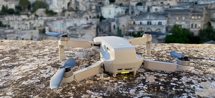
The integration of drones into urban ecological monitoring represents a transformative advancement in how cities manage and enhance their green spaces. Drones offer a unique perspective and capabilities that traditional methods simply cannot match. By utilizing aerial imagery and advanced sensors, urban planners and ecologists can obtain real-time data on vegetation health, biodiversity, and ecosystem changes.
- Enhanced Data Collection: Drones can cover large urban areas quickly, capturing high-resolution images and data that facilitate comprehensive analysis of green spaces.
- Monitoring Biodiversity: Drones equipped with multispectral cameras can identify various plant species and monitor their health, contributing to effective biodiversity management.
- Assessing Environmental Impact: By observing changes over time, drones assist in evaluating the impact of urban development on local ecosystems, leading to better decision-making.
- Precision Agriculture: In urban agriculture, drones can optimize crop management, ensuring that green spaces contribute efficiently to the urban environment.
Furthermore, the use of drones allows for the detection of invasive species and diseases that threaten urban flora. This proactive approach enables timely interventions, preserving the integrity of urban ecosystems. As cities strive for sustainability, the role of drones in ecological monitoring becomes increasingly crucial.
By providing detailed insights into urban green spaces, drones facilitate the development of targeted strategies that enhance ecological balance. This technology not only supports environmental health but also promotes community engagement by fostering awareness of urban biodiversity issues.
In conclusion, the revolutionary application of drones in urban ecological monitoring is reshaping the management of green spaces. As cities continue to grow, the need for innovative solutions to maintain and improve urban ecology will only increase. Drones stand at the forefront of this movement, offering invaluable tools for urban ecologists and planners alike.
Drones in Action: Enhancing Biodiversity and Habitat Restoration in Cities
In urban environments, the integration of drones has proven to be a transformative approach for enhancing biodiversity and facilitating habitat restoration. Drones play a crucial role in assessing and monitoring ecological health, enabling city planners and environmentalists to gain valuable insights into urban ecosystems.
One of the primary advantages of using drones in urban ecology is their ability to cover large areas quickly and efficiently. Equipped with advanced sensors and imaging technology, drones can collect data on vegetation health, species distribution, and habitat conditions. This information is essential for understanding the ecological dynamics of urban areas.
- Mapping and Surveying: Drones can create detailed maps of urban green spaces, identifying areas that require restoration or enhancement. This mapping capability allows for targeted interventions that promote biodiversity.
- Seed Dispersal: Innovative drone technology enables the aerial dispersal of seeds in hard-to-reach areas, facilitating the growth of native plant species that support local wildlife. This method enhances flora diversity and contributes to habitat restoration.
- Monitoring Wildlife: Drones can facilitate the observation of urban wildlife, providing insights into animal behaviors and habitats without disturbing these species. This monitoring is vital for ensuring the sustainability of urban biodiversity.
- Data Collection: Drones can gather critical environmental data, such as temperature, moisture levels, and air quality, which contribute to a better understanding of how urban ecosystems function.
The use of drones in urban ecology not only enhances biodiversity but also promotes community engagement. By involving local residents in conservation efforts and educational programs, cities can foster a greater appreciation for their natural surroundings. This engagement is essential for creating a sustainable urban future.
Ultimately, the application of drones in urban ecology presents a forward-thinking solution for addressing the challenges of biodiversity loss and habitat degradation in cities. As technology continues to evolve, the potential for drones to revolutionize ecological practices will only grow, paving the way for healthier urban environments.
Precision Agriculture in Urban Areas: How Drones are Transforming Food Production
Precision agriculture in urban areas is being revolutionized by the integration of drones into food production systems. These advanced aerial technologies are transforming traditional farming practices, enabling urban growers to optimize their resources and enhance crop yields. Drones equipped with high-resolution cameras and sensors provide detailed aerial imagery, allowing for real-time monitoring of plant health, soil conditions, and resource distribution.
- Data Collection: Drones gather extensive data on crop health, enabling urban farmers to make informed decisions.
- Resource Management: With accurate aerial insights, water and nutrient usage can be minimized, leading to sustainable urban agriculture.
- Pest and Disease Detection: Early detection of pests and diseases through drone surveillance aids in timely intervention, reducing crop loss.
- Precision Planting: Drones assist in precise planting techniques, ensuring optimal spacing and placement of seeds in urban environments.
- Yield Prediction: Enhanced data analysis from drones allows farmers to predict yields more accurately, facilitating better market planning.
The role of drones in urban agriculture extends beyond mere observation. Their capability to perform detailed analyses fosters a more sustainable approach to food production, addressing the challenges of limited space and resources in city environments. By employing drones, urban growers can create healthier ecosystems that not only contribute to food security but also promote biodiversity within metropolitan areas.
Furthermore, the use of drones can lead to improved community engagement in urban agriculture. By showcasing the benefits of precision farming through aerial footage, awareness can be raised about the importance of sustainable practices in food production. This not only encourages local participation but also cultivates a stronger connection between urban residents and their food sources.
As urban areas continue to grow, the adoption of drones in precision agriculture will play a crucial role in shaping the future of food production. Their ability to collect and analyze data effectively positions them as essential tools for urban farmers striving to meet the demands of an increasing population while maintaining ecological balance.
Mapping Urban Wildlife: Utilizing Drones for Effective Species Tracking
Utilizing drones in urban environments has revolutionized the way wildlife is studied and monitored. The integration of drone technology into ecological research allows for precise mapping of urban wildlife populations, significantly enhancing species tracking efforts. Drones provide an aerial perspective that is often unobtainable through traditional methods, enabling researchers to gather extensive data on various species inhabiting urban areas.
- High-Resolution Imaging: Drones equipped with advanced cameras capture high-resolution images, allowing for detailed assessments of wildlife habitats.
- Real-Time Data Collection: Drones can collect and transmit data in real-time, facilitating immediate analysis and timely decision-making for conservation efforts.
- Access to Hard-to-Reach Areas: Urban landscapes often include challenging terrains. Drones can easily navigate these areas, providing insights into wildlife populations that may otherwise remain unmonitored.
- Minimizing Disturbance: The use of drones minimizes human interaction with wildlife, reducing stress on animal populations and ensuring more accurate behavioral observations.
Through aerial surveys and monitoring, drones contribute significantly to understanding urban wildlife dynamics. This technology aids in identifying patterns of animal movement, which is crucial for developing strategies aimed at promoting biodiversity in urban settings. Effective species tracking using drones not only enhances knowledge of local ecosystems but also informs urban planning and conservation initiatives.
In conclusion, mapping urban wildlife with drones represents a cutting-edge approach to improving ecological awareness and management in cities. By harnessing the capabilities of drones, urban ecologists can unlock new opportunities for species tracking, ultimately fostering healthier urban ecosystems that support diverse wildlife populations.
Innovative Solutions: Drones as Tools for Urban Pollution Assessment
In recent years, the integration of drones into urban pollution assessment has revolutionized the way cities monitor and manage environmental challenges. Drones, equipped with advanced sensors and imaging technology, provide a cost-effective and efficient means to gather real-time data on air and water quality, as well as urban heat islands.
The deployment of unmanned aerial vehicles (UAVs) allows for comprehensive assessments of urban areas, enabling environmentalists and city planners to identify pollution hotspots. By utilizing drones, cities can gather crucial data that informs decision-making processes aimed at improving urban ecology.
- High-resolution aerial imagery: Drones capture detailed images that help identify sources of pollution, such as industrial emissions or traffic congestion.
- Real-time monitoring: UAVs can be deployed rapidly to assess pollution levels during specific events, such as traffic spikes or weather changes.
- Access to hard-to-reach areas: Drones can easily navigate urban landscapes, providing data from locations that are difficult for traditional monitoring methods to reach.
- Cost-effectiveness: Utilizing drones significantly reduces the operational costs associated with extensive ground-based pollution assessments.
The ability of drones to collect and analyze environmental data positions them as indispensable tools in urban ecology. As cities continue to grapple with pollution challenges, the adoption of drone technology will likely expand, enhancing the capacity to monitor and mitigate environmental impacts effectively.
As urban areas become increasingly populated, the importance of innovative solutions, such as drone-assisted pollution assessment, cannot be overstated. By leveraging the capabilities of drones, cities can pave the way for a cleaner, healthier future.
The Future of City Planning: Integrating Drone Technology for Sustainable Development
The future of urban development is increasingly intertwined with advanced technologies, particularly drone technology. Integrating drones into city planning can significantly enhance urban ecology, promoting sustainable development while addressing environmental challenges. These unmanned aerial vehicles (UAVs) offer innovative solutions for monitoring, managing, and improving urban environments.
- Environmental Monitoring: Drones equipped with sensors can collect real-time data on air quality, temperature, and noise levels. This data is essential for understanding urban ecological health and implementing effective policies.
- Green Space Management: Drones can assist in mapping and maintaining urban green spaces. They provide aerial views that help in assessing vegetation health and planning for new parks and community gardens.
- Waste Management: Utilizing drones for waste management allows for efficient monitoring of waste collection routes and illegal dumping sites. This technology facilitates quicker responses to waste-related issues, contributing to cleaner cities.
- Emergency Response: Drones can play a crucial role in disaster management by providing aerial surveillance during natural disasters. They help in assessing damage and planning recovery efforts, ensuring sustainability in rebuilding processes.
Moreover, the integration of drone technology in urban planning can enhance public participation. Community members can engage in data collection and analysis, fostering a sense of ownership over local ecological initiatives. This collaborative approach is vital for the success of sustainable urban development.
As cities evolve, the challenges of urbanization require innovative solutions. Drones represent a pivotal advancement in achieving these goals, enabling smarter, greener cities. The strategic use of drone technology can lead to improved urban ecology, ensuring that future developments align with sustainability objectives and enhance the quality of life for all residents.
